Another workshop:
FAKE NEW GORICA
Welcome to Nova Gorica – the town of daisies. These are the flowers that can be seen in our town’s coat
of arms. Today you’re going to walk around the oldest town in Slovenia.
In 1947, a new border between Italy and Yugoslavia (Slovenia) was established and Gorica was annexed to
the Italian side. Consequently, the northern part of the Slovenian Littoral (the Goriška region) was cut off
from its traditional regional urban centre. The authorities decided to establish a new administrative and
economic centre – the town of Nova Gorica. Its construction began in 1948. The plan of the town was
designed by the architect Edo Ravnikar, whose idea was to make a ‘town with parks’ with a socialist hint.
Your route is going to start towards the east. Your first stop is at the scale model of Nova Gorica, which is
situated on the other side of Bevk Square (Bevkov trg). The current town looks different from the one on
the model (only 11 buildings are the same), because the authorities ran out of money for the
construction, and a lot of people immigrated to the area in a very short period of time, so the
construction had to be accelerated. On the other hand, the main road named Churchill Street
(Churchillova ulica) is well visible on the scale model. There is also one of the first buildings there, which is
situated just on the other side of the road – the town hall. On the scale model it is also possible to see the
trees that are planted throughout the town even today.
If you look towards the roundabout (towards the south-east), you will see a skyscraper on the other side
of the road. It was built in 1965 and it was supposed to be like a lighthouse that enlightened all the
beauties and greatness of the socialist system towards the west. The town of Nova Gorica promotes itself
as ‘the town on the meadow’ (the meadow in front of the town hall), but until the beginning of World
War I in the central part of the town there was a cemetery belonging to the town of Gorica.
GROUP SELFIE IN FRONT OF/BY THE SCALE MODEL
Your route continues past the roundabout along Erjavec Street (Erjavčeva ulica), which connected the
town of Gorica to the cemetery. Here on your right there is the monument dedicated to all ‘work
brigadiers’ – the young volunteers coming from all over Yugoslavia, who helped to build the town until the
70s in the 20 th century. On the opposite side of the road you will see a small copy of Cheops Pyramid and
the adjacent Slovenian flag. This is a monument dedicated to the Ten-Day Slovenian War of Independence
which took place in June 1991. A few metres ahead on this side of the road there is a high, white
monument dedicated to the first Slovenian aviator Charles Lindberg, who died in Belgrade in 1911 as the
34 th victim of flying. Next to the monument there is the tallest skyscraper in Slovenia which is named after
the first Slovenian aviator – the Eda centre. Your route continues through the centre where one of his jet
planes is on exhibition.
GROUP SELFIE AT THE JET PLANE
Your route continues along Erjavec Street (Erjavčeva ulica) and past the blue building named frnaža. This
was also the name of the first centre of Nova Gorica up to the 60s in the 20 th century. The building stood
in the proximity and it was originally used as a furnace for brick production. However, later on it was used
as a facility for flats, shops, service activities, etc. As years passed by, the building wasn’t suitable for those
activities anymore, therefore it was gradually demolished by the late 60s. While you are walking along
Erjavec Street (Erjavčeva ulica) towards the railway station, you will find out why the street is nicknamed
‘the celebrity avenue’. On both sides of the road there are statues and monuments dedicated to famous
people from the Goriška region and other famous Slovenians. There aren’t any women among them.
When you come to the crossroads with Delpin Street (Delpinova ulica) – the last crossroads with traffic
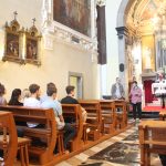
lights in front of the railway track – on the left side you will see the Franciscan monastery with the church
consecrated to Mary of Kostanjevica (the local people call the church Kapela). The monastery maintains a
collection of ancient books and the human remains of the only French king (Charles X) who is buried
outside the borders of France.
A few metres ahead, you will see the ice-cream shop named Leone. On the wall of this building there is
the label of the water level during the last flood which affected Nova Gorica in 1983, because at that time
the dam on the River Soča wasn’t built yet. When you cross the railway tracks, turn right towards the
railway station of Nova Gorica, which was built in 1906 and was the northern railway station of the town
of Gorica before World War II. It is considered as the oldest public building in Nova Gorica, being built in
Renaissance style.
In front of the railway station there is Europe Square (Trg Evrope/Piazza Transalpina), which stands for
the symbol of the two united towns, the fall of the national border and the accession of Slovenia to the
European Union in 1991. The square was designed by the Italian architect Franco Vecchiet, who lives in
Trieste (Italy) but has Slovenian roots. The square consists of parallel grey and white lines, which
symbolize a pedestrian crossing or, in other words, the possibility to cross the border freely from one
country into another. On the parallel lines there are the shiny parts of the numbers 57 and 15, which are
the numbers of the boundary marker that used to be situated in the middle of the current square. Thus,
the smashed boundary marker simply means that the border is gone.
GROUP SELFIE ON THE SQUARE
Congratulations! You have reached your destination.
Written by: Tomaž Komel
Translated by: Tjaša Rotar Komel